Lush greens in an El Niño year?
A trip up north
We just got back from a wonderful trip up north. After years, I finally made it to Mungo National Park to see the vast desert landscape and the home of Mungo Man and Mungo Woman. Thousands of years ago, precisely 42,000 years ago during the Pleistocene, the desert was a flourishing lakeside enabling fishing and access to water, surrounded by green vegetation, and a potentially nice home for the First Nations peoples. Nowadays, the once seventeen interconnected lakes have dried up, leaving behind eroded sand dunes of spectacular appearance.
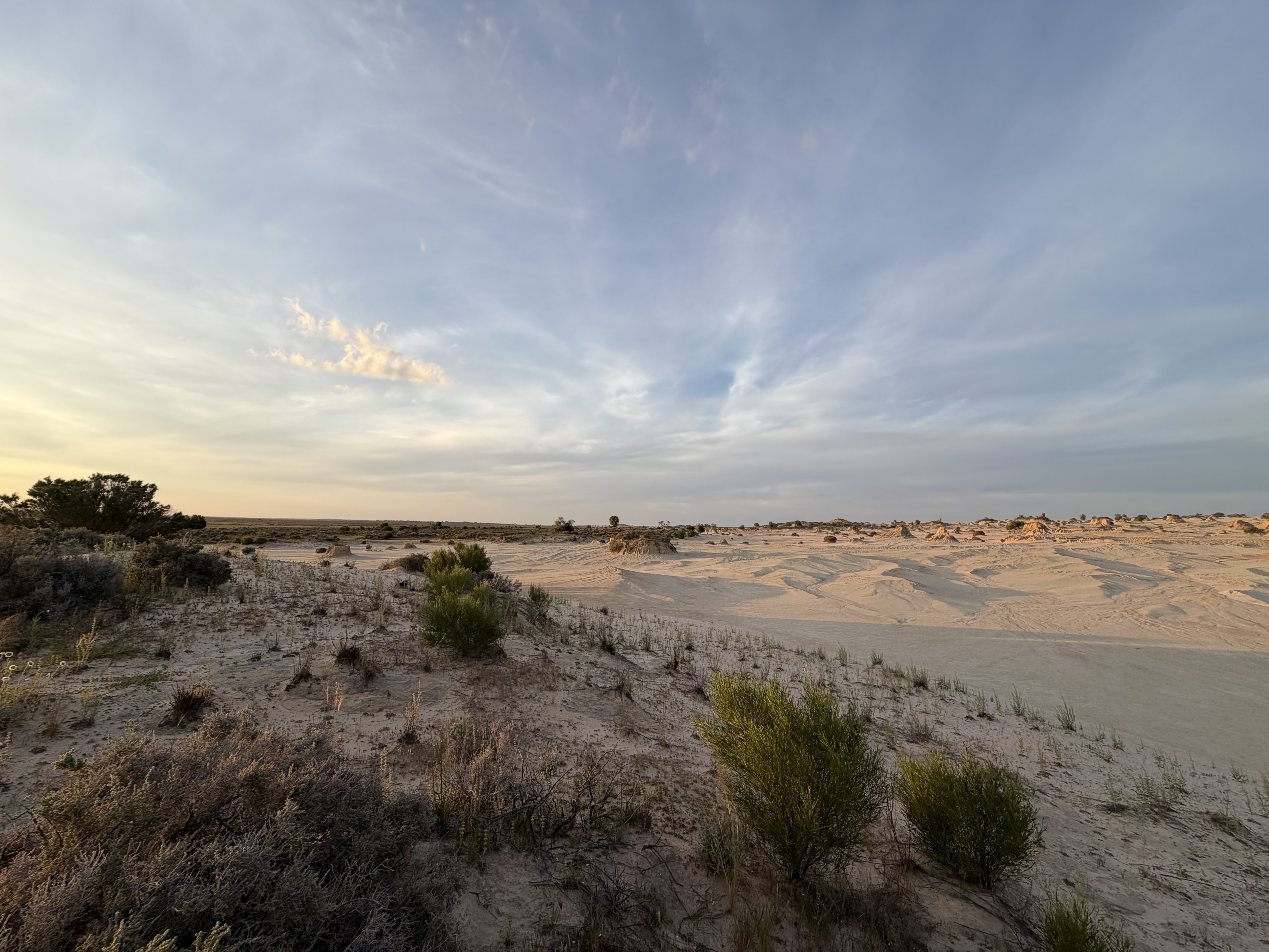
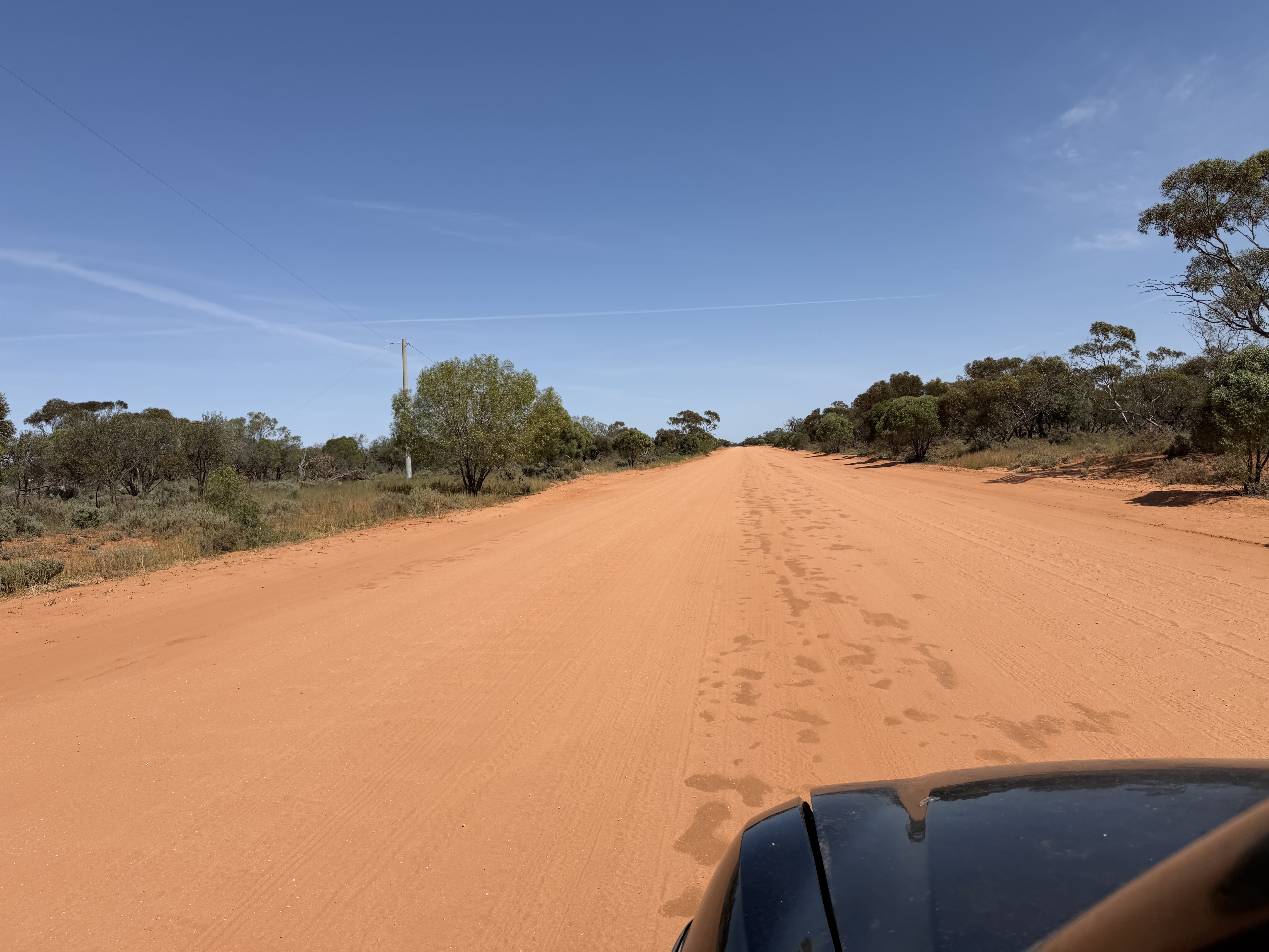
To get to Mungo National Park, it’s about a 7-hour drive from Melbourne through the beautiful countryside of Victoria, past the lush and productive region sprawled along the Murray River, into the more arid regions of New South Wales. Often accompanied by beautiful wildflowers, the remote roads run straight for hours without any traffic. Almost meditative to travel along.
Lush greens in an El Niño year
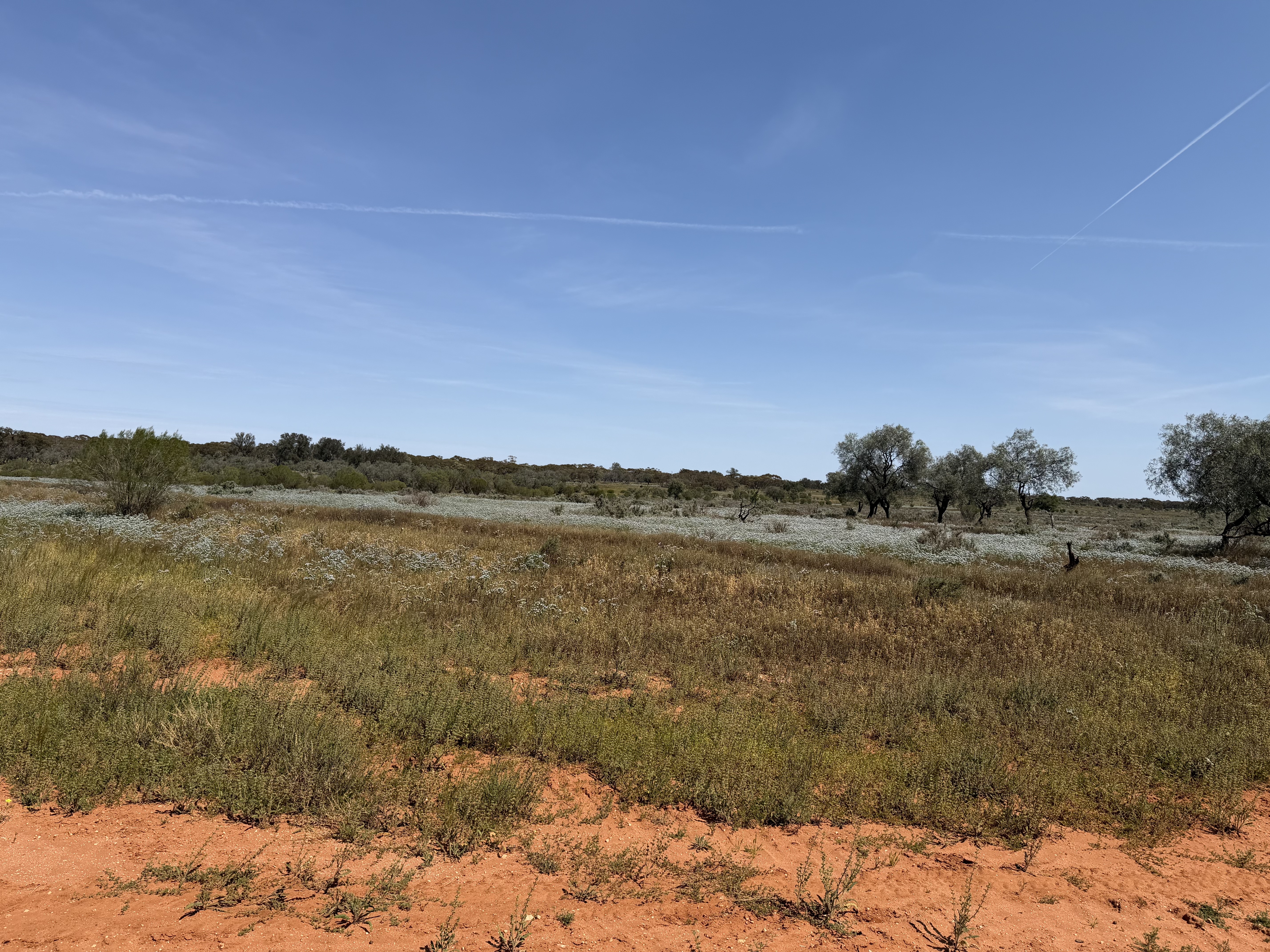
I expected vast landscapes, sand and dirt roads, but what we mostly saw surprised me a lot: flourishing agricultural land with grains, including wheat and canola.
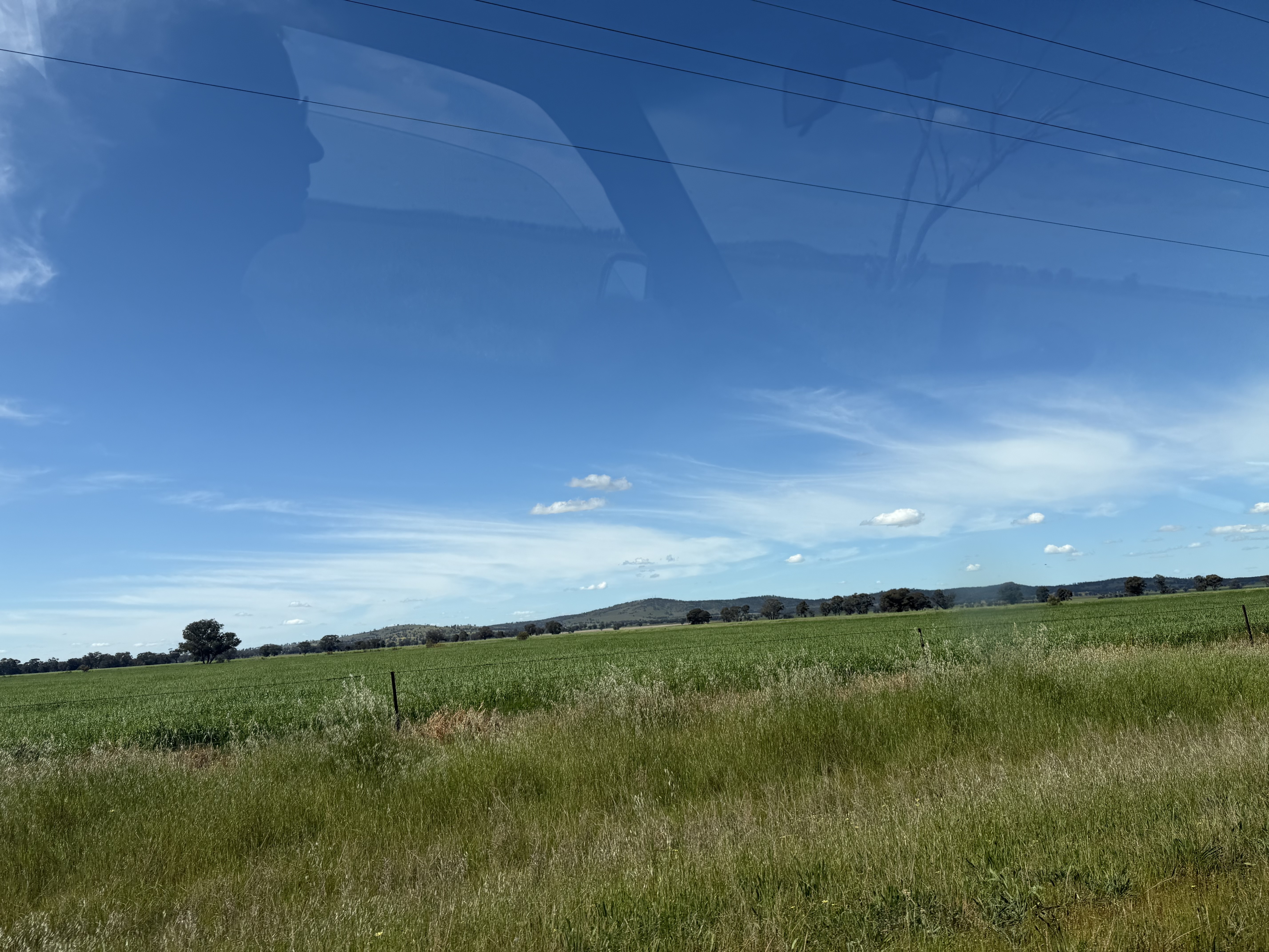
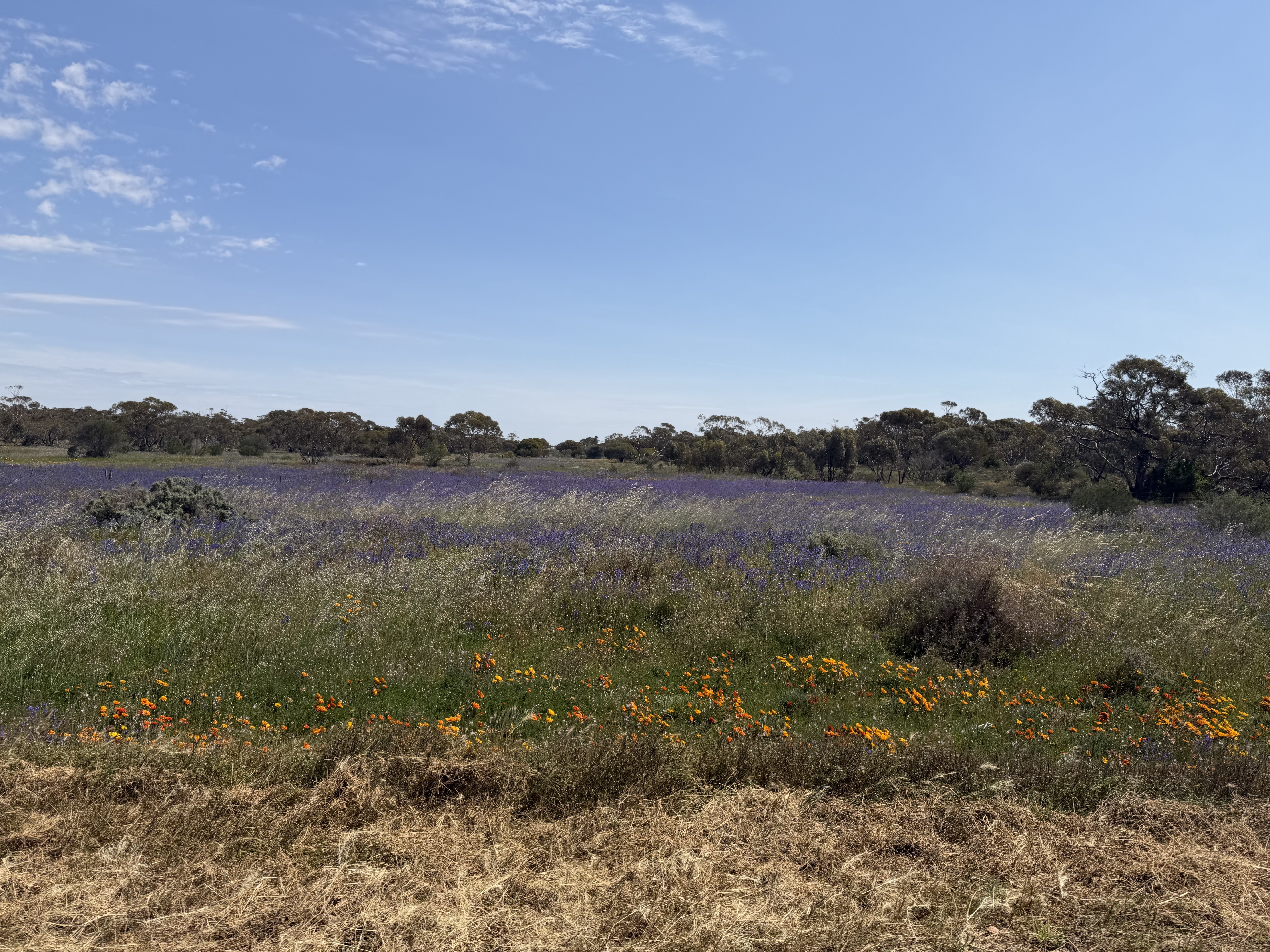
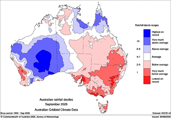
Going up north inland during an El Niño year, I expected to see drier than usual conditions, but not lush greens. A first glimpse at September rainfall looked almost exactly like what I would have pictured. Large parts of southeastern Australia received well below average rainfall, and some parts experienced their driest September on record. This almost perfectly fits the expected spatial pattern of spring precipitation during an El Niño. Spring in Australia is usually the time when the impact of El Niño is felt most strongly.
The rain that came before
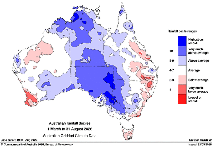
The answer lies in the months prior to spring. Large parts of South Australia, northern Victoria and inland New South Wales experienced a blast of autumn and winter rainfall. Even for early sowing in late April, there was plenty of moisture available in large parts of the country. Quite sustained rainfall, and in some parts the wettest autumn and winter on record, seems to have provided perfect growing conditions. It suddenly made so much sense. I remembered those news stories about happy farmers welcoming lots of rain despite the looming El Niño prediction.
In essence, it gave me a very different view of El Niño events and their impact on vegetation and agricultural production. There is more to the story than the tendency of a drier than usual spring. Conditions prior to an El Niño event and the timing of rain seem much more informative than the simple doom-laden news of El Niño that people associate with drought conditions. In Australia, El Niño events and poor harvests are not as tightly linked as often assumed. A strong El Niño does not automatically mean low rainfall or a bad harvest. Fortunately, the strength of an El Niño event is only loosely linked to the weather you can expect in Australia. And similarly, conditions beyond a single event play a much bigger role.