A dull crossing & what it means for Australia
This week the tropical Pacific has seemingly crossed a dull threshold. Not very exciting or significant, but it scares people around the globe.
For the first time in the past two years, the relative (meaning long term warming signals have been accounted for) Niño 3.4 index has crossed the zero line and entered positive anomalies. This is not historic. It happens quite often, sometimes even randomly. But given this year’s forecasts, many people are holding their breath.
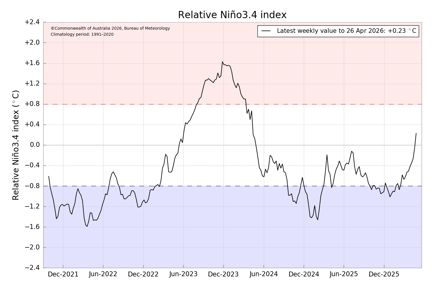
We are still not quite in the window of certainty, but more indications are beginning to line up. This past week, the Niño 3.4 index shifted from negative to slightly positive: +0.23 °C. That doesn’t sound like much — and fair enough. We are still far from the official threshold of +0.8 °C and other key requirements remain unmet.
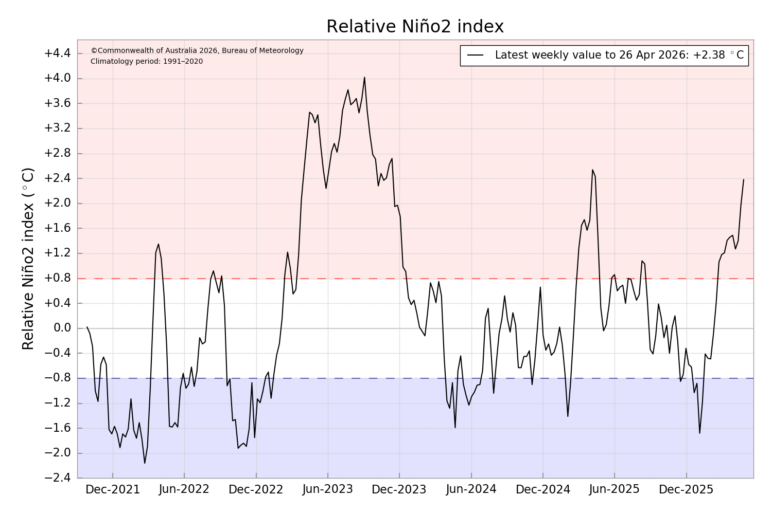
Looking to the Niño 1+2 region suggests something may be unfolding: the tropical Pacific is warming from the east and slowly extending westward toward the dateline, a incomplete signal but one moving in a familiar direction. When the eastern indices (Niño 1+2) and Niño 3.4 begin to move together like this, it often hints that the system may be tilting toward an Eastern Pacific El Niño.
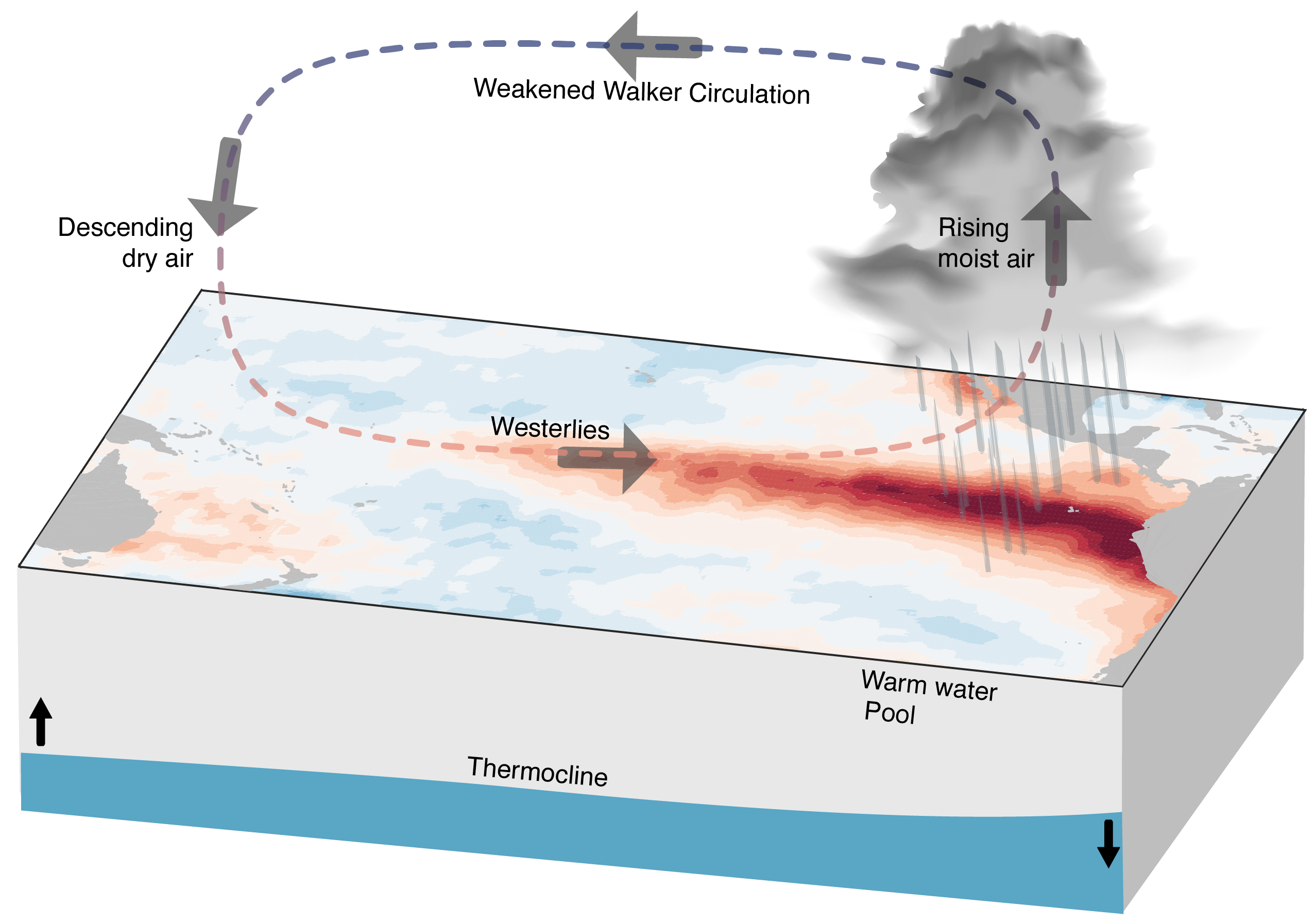
Eastern Pacific El Niño
The Eastern Pacific El Niño is the classic version — the one most people mean when they say “El Niño.” The trade winds weaken, upwelling off South America slows, and the eastern Pacific warms. As warming increases, convection follows the heat from unusually warm sea-surface temperatures, bringing large shifts in circulation patterns such as the Walker circulation.
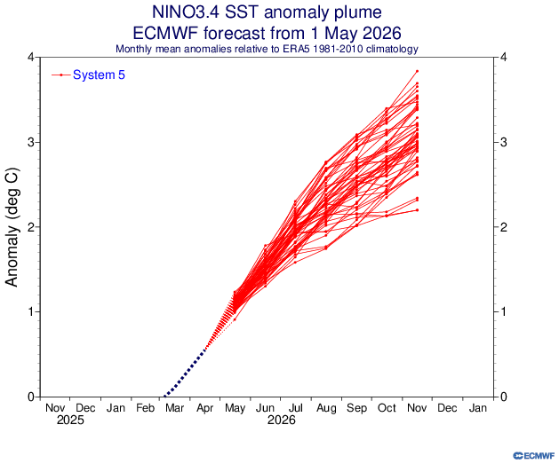
Now, with an increasing likelihood of an El Niño calling out loud, being mega or monster El Niño, where does that come from? Very clearly, from a striking glimpse at the latest seasonal forecast from the ECMWF. You don’t have to study atmospheric or climate science to understand why this looks huge:
Do you need to be worried in Australia?
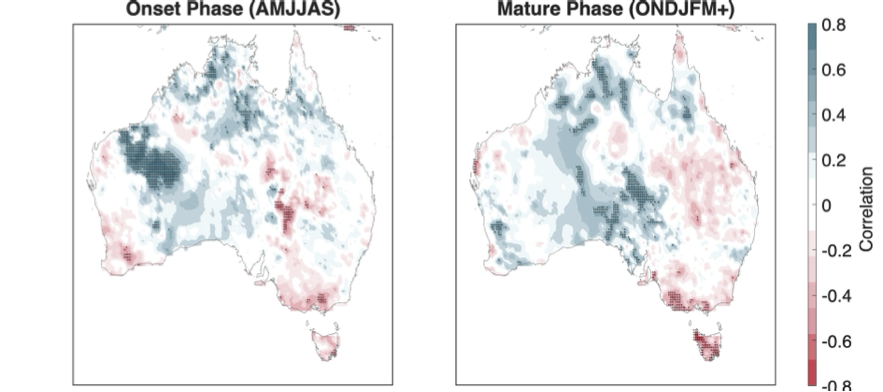
The answer depends on whether you see the glass as half empty — or simply realistic. On average, El Niño events tend to bring drier than usual conditions, particularly in eastern regions. There’s nothing especially dramatic about this overall signal, but parts of eastern Australia do often end up drier than normal. Looking at rainfall through rolling shows regions where deficits become statistically significant. But then again, what does “normal” really mean in Australia?
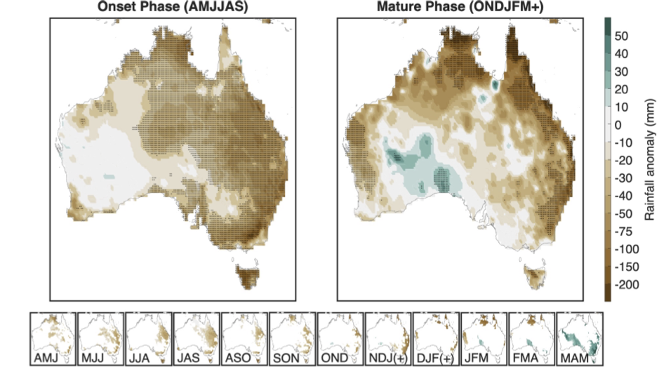
Even a big El Niño doesn’t mean big dry
The important point here, and we are far from the first to show this, is that regardless of how strong or weak an El Niño is, we have very little idea what that actually means for rainfall in Australia. A “mega” El Niño does not automatically translate to “mega” dry conditions. Even strong El Niño events can be associated with fairly unremarkable, near‑average rainfall. Looking at past events shows no clear relationship between El Niño strength and Australian rainfall. El Niño strength and Australian rainfall are not well correlated and should not be used interchangeably.
Big El Niños make good headlines — but poor rainfall forecasts
As you can see, things are not as straightforward as they might seem — at least for Australia. In other parts of the world, there are regions where El Niño does consistently shift rainfall risk. Even in those cases, however, fully coupled seasonal prediction models provide a far better estimate of expected rainfall because they account for the full complexity of the climate system. They move beyond simple narratives and take into account interacting oceanic, atmospheric, and land processes — not just the doom‑laden tale of a “mega” El Niño.